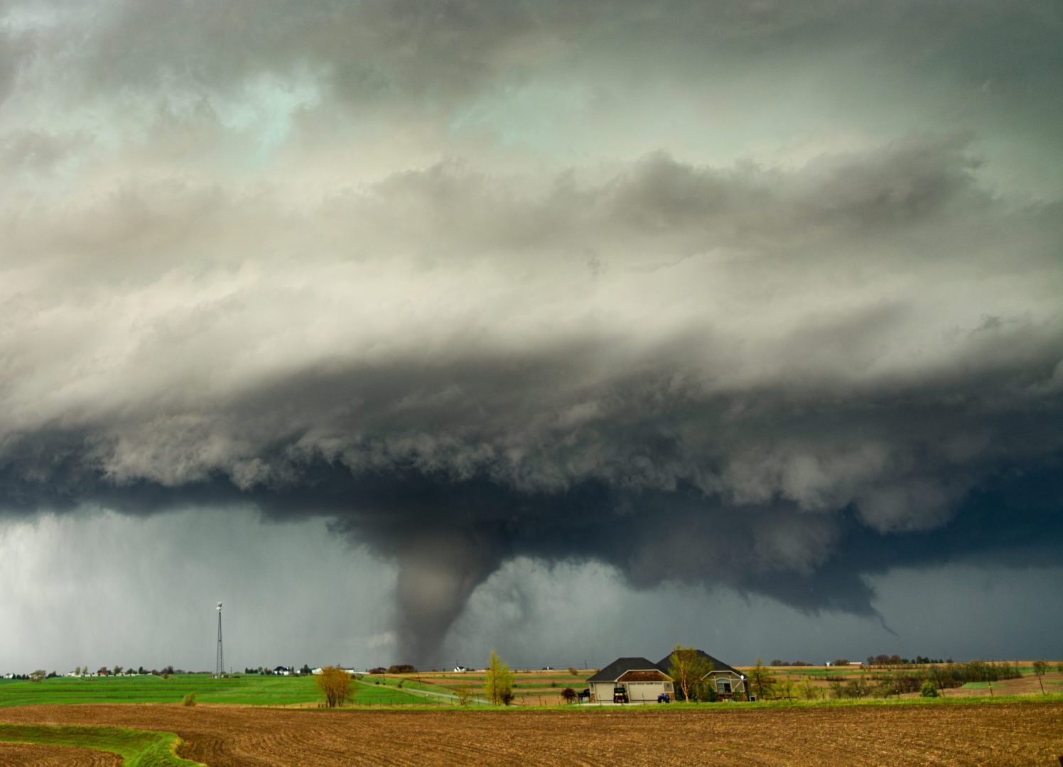
Two tornadoes touched down in central Illinois as powerful storms swept across the region.
Central Illinois residents faced a dangerous evening of severe weather on June 17 as powerful storms spawned two confirmed tornadoes, produced damaging winds and unleashed large hail across parts of the state.
One of the tornadoes was captured on video between Mattoon and Charleston, showing a large funnel moving across open land as dark storm clouds churned overhead. Weather officials later confirmed that at least two tornadoes touched down in central Illinois as the storm system intensified.
The storms arrived in waves after an earlier round of severe weather moved through the Springfield area Wednesday morning. Forecasters had warned residents that the second wave of storms during the afternoon and evening carried the greatest risk for dangerous conditions.
Central Illinois faced a rare high risk weather setup
Much of central Illinois was placed under a Moderate Risk for severe weather, which is a level 4 out of 5 on the National Weather Service scale. The designation is reserved for days when widespread and potentially significant severe weather is expected.
Meteorologists warned that the atmosphere contained all the ingredients needed for dangerous storms, including the possibility of tornadoes, destructive wind gusts, large hail and frequent lightning.
Strong winds were already being felt across the region before the storms fully developed. Gusts reached around 45 mph in many locations throughout the afternoon, creating hazardous conditions even before tornado warnings were issued.
Weather officials had spent days tracking the system as it approached Illinois. Forecast models suggested storms would move quickly across the state, increasing the challenge for residents trying to stay ahead of rapidly changing conditions.
Tornadoes developed as storms raced across the state
As the evening progressed, reports of tornadoes began emerging from central Illinois.
Video recorded between Mattoon and Charleston showed one tornado stretching from the clouds toward the ground as it moved across rural areas. The footage quickly spread online as residents and weather watchers monitored the storm’s path.
The National Weather Service later confirmed that two tornadoes had touched down in the region.
Forecasters had cautioned earlier in the day that while tornadoes are notoriously difficult to predict, the environment could support stronger twisters if they formed. Meteorologists noted that storms developing in Illinois had the potential to produce powerful tornadoes, raising concerns as the weather system intensified.
Fortunately, tornadoes often strike isolated areas, though officials continued urging residents to remain alert for changing weather conditions and emergency warnings throughout the evening.
Severe thunderstorm warnings covered multiple counties
Beyond the tornado threat, severe thunderstorms affected several counties in central Illinois.
The National Weather Service office in Lincoln issued a severe thunderstorm warning for central Montgomery County and eastern Macoupin County during the evening hours. Forecasters warned residents to prepare for wind gusts reaching 60 mph along with hail as large as half dollars.
The warning area included portions of Interstate 55, particularly near communities such as Litchfield, Raymond, Taylorville and Hillsboro.
Drivers were advised to use caution as storms moved rapidly through the region. High winds and hail can make travel dangerous, especially on major highways where visibility may suddenly decrease because of heavy rain.
Emergency officials continued monitoring conditions as the storms advanced eastward.
Communities remain alert as severe weather season continues
The outbreak serves as another reminder of how quickly severe weather can develop across the Midwest during late spring and early summer.
Illinois is no stranger to tornadoes, but days featuring a Moderate Risk designation remain relatively uncommon. Such forecasts often prompt emergency managers, local officials and residents to closely monitor weather updates and prepare for rapidly evolving situations.
As damage assessments begin and meteorologists continue reviewing storm data, officials are urging residents to remain vigilant throughout the severe weather season.
With powerful storms capable of producing tornadoes, damaging winds and large hail in a matter of minutes, preparedness remains one of the most important tools for staying safe when severe weather strikes.